As part of the ReCoMaP’s funded coastal zone project, a stakeholder workshop was carried out in the first week of May on Denis Island. The main aim of the workshop was to introduce the stakeholders of Denis Island to the ReCoMaP project and Integrated Coastal Zone Management (ICZM) processes The setting up of the beach profiling points and the turtle monitoring protocol as well as training on beach profiling methods, turtle identification and tagging were the key workshop outputs.. After the initial stakeholder consultations on Denis Island in April, GIF staff also included presentations on coastal erosion and turtle monitoring. Concerns on these aspects of the island were raised during the initial stakeholder consultations. A steering committee was set up as well on the island to ensure that the project is being implemented and at the same time promote conservation initiatives within the island community.
The potential steering committee members had already been shortlisted previously on Mahe with following discussions with the Managing Director of the Denis Island Development Pty Ltd. This was the more realistic approach to use when staff movement, shifts and the island’s everyday operations are taken into consideration. A large number of the proposed members included front office staff because they are generally the first point of contact with visitors of Denis Island and it was found that the selected members were very keen to participate in the project. A list of equipment which includes a desktop computer, turtle tags and an applicator, GPS, beach profiling poles and an abney level were given to the chairperson of the steering committee to assist in the monitoring of the key coastal indicators.
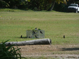
The first part of the workshop involved the various presentations on the key coastal indicators of the island, which pertain mostly to coastal dynamics and biodiversity. Great levels of interests were generated from the participants, following the theoretical aspects of the training. The level of enthusiasm for the field survey surely surpassed our expectation. The photos on the side bar illustrate this clearly. Setting up the beach profiling reference points: The project team decided to use the standard Seychelles beach profiling method that was officially launched in July 2003. The method was developed by Dr. Gillian Chambers and is simple and easy to use. GIF adopted this method so as to enable data comparison between islands as this method is the Seychelles’ standard. The GPS reference of each point was also recorded.
At the end of the workshop and during the island visit, the monitoring stations for the beach profiles were established (see map above), the first data set was collated and a group of keen volunteers was identified to partake in data collection.

Figure 1:Map of Denis Island with the location and number of the reference points for the beach profiling monitoring exercise and the 6 different turtle monitoring sections.
For more information on the workshop for the Grand Anse Praslin site, do check the Green Islands Foundation blog on:


No comments:
Post a Comment